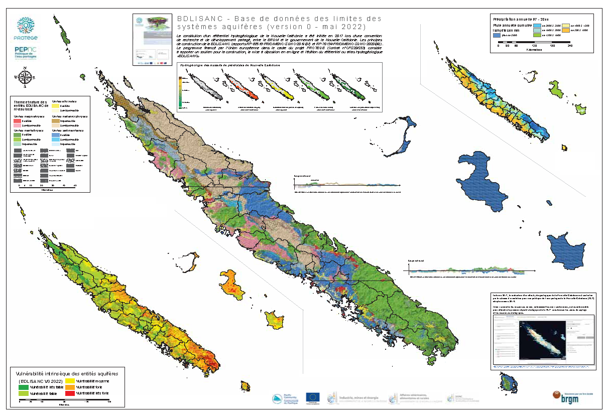
The hydrogeological atlas BDLisa is now available !
The hydrogeological atlas BD Lisa has been produced by the Geological Service (SGNC) of the DIMENC, Government of New Caledonia, it now makes it possible and now gives the ability to identify strategic groundwater resources on New Caledonian territory.
BDLISA-NC is the repository of New Caledonia's aquifer formations.
It is now public and accessible to all by accessing the Explo'Lisa on georep.nc.
The atlas was supported by New Caledonia, the Bureau de recherches géologiques et minières (BRGM) and the Pacific Community (SPC) within the framework of the PROTEGE programme funded by the European Union.
Its objective is to improve and disseminate knowledge of groundwater resources for better management.
The available data on pressures and issues have been incorporated into the BDLISA-NC hydrogeological features and a map of the intrinsic vulnerability of these features has been produced (see image below).
BDLISA-NC thus contributes to the identification of the territory's strategic groundwater resources, as requiredin the Orientation Plan for a Shared Water Policy (PEP) carried by the New Caledonian Government.
Hydrogeological map of New Caledonia from BD LISA - Georep.nc, DIMENC NC - Government of New Caledonia.

Hydrogeological map of New Caledonia from BD LISA - Georep.nc, DIMENC NC - Government of New Caledonia