Pavement level markers installed along the RT1 - New Caledonia
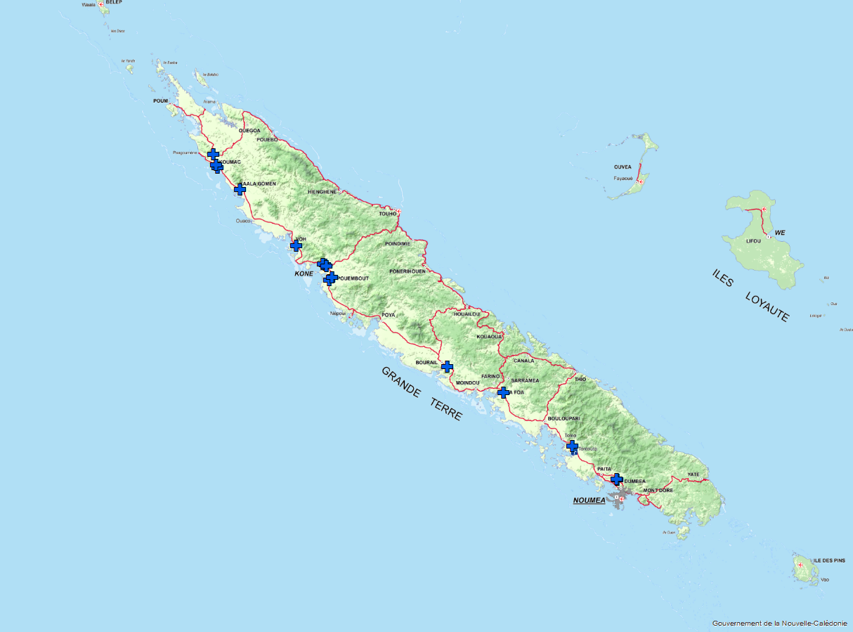
Through PROTEGE funding, 2 m high flood level markers and J6 roadside markers were installed at twelve frequently flooded sites on Territorial Route 1 (TR1).
The 2-meter-high flood markers are graduated every 20 cm to facilitate reading from a large distance (75 to 150 m). It’s a safe way to check the water level on the roadway. These flood markers are installed at the lowest point of the roadway, where the water level is highest during a flood.
The flood marker is not a tool allowing driver to cross flooded roads. It is a reminder that from 30 cm of water, there is a risk to see a vehicle washed away because its underbody starts to float.
A submersion scale, also called "limnimetric scale", allows to measure the variations of the river from point zero of the scale. In New Caledonia, they are located :
- at the edge of a stream bank;
- in the vicinity of a watercourse on the edge of a road;
- on portions of roads affected by rising water.
The submergence marker also represents a prevention tool for the population and administrations. It indicates that there is a danger. It is necessary that the populations know the rivers and the associated overflows.
The state of the floods is measured in order to allow the authorities and the populations to take all the necessary precautions.
Finally, these markers will also contribute to data collection for the technical services in charge of the studies of floodable zones, for example through the re-use of geo-referenced and time-stamped photographs.
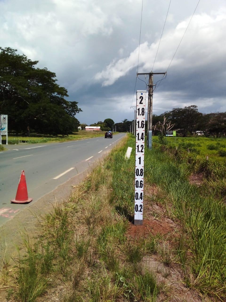
These submersion markers consist of white plastic J6 beacons about 1m high, topped with a black reflective border. They are intended to delimit the roadway in case of flooding emergency. The installations were carried out by the company Pacifique Marque.
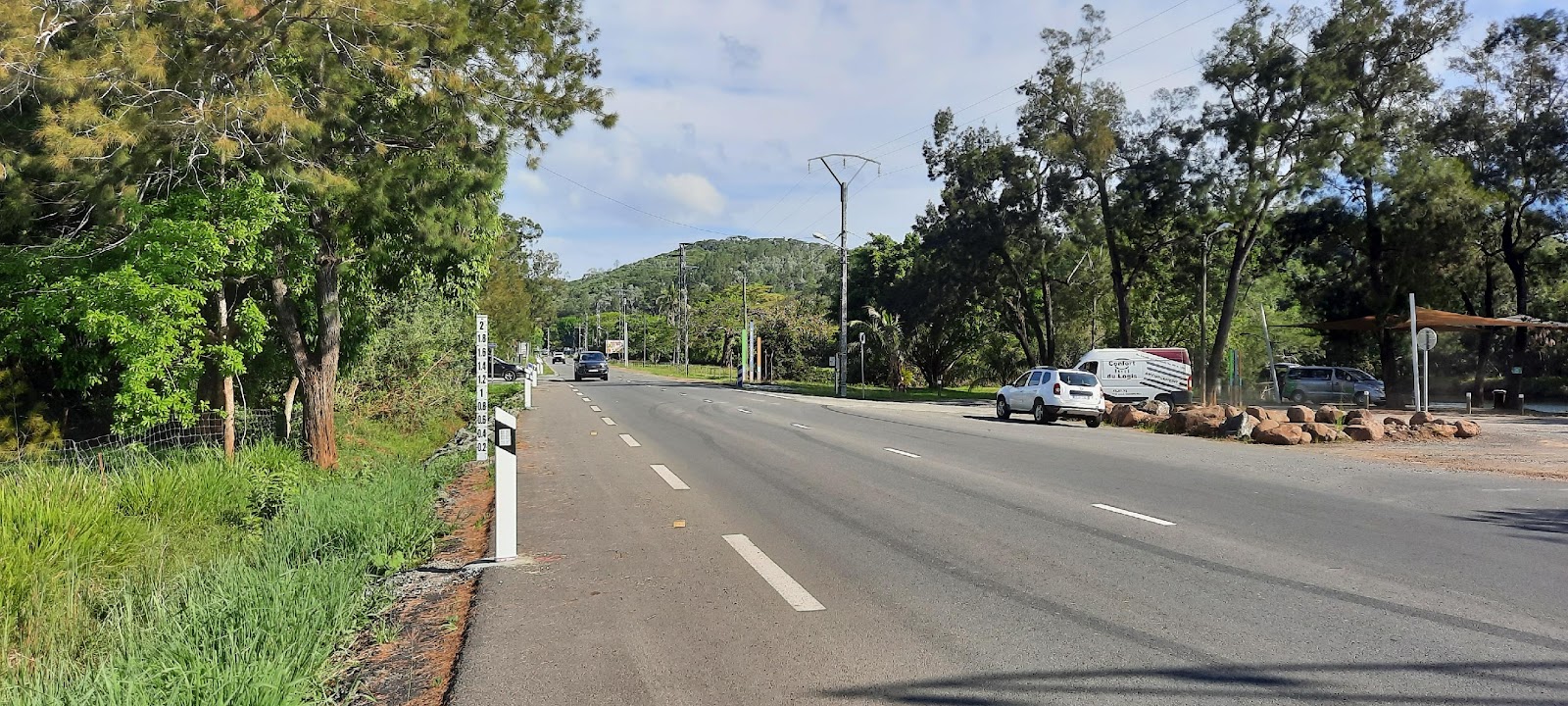
The sites and the exact location of the flood level markers were selected from studies carried out by the New Caledonian Infrastructure, Topography and Land Transport Services (DITTT). The latter then relied on the New Caledonian Civil Security and Risk Management department (DSCGR) and the Veterinary, Food and Rural Affairs Department (DAVAR), the in-country PROTEGE lead for implementation of the water component of the project.
- 12 sites have been equipped between November 2021 and January 2022:
- Dumbéa at Fayard Park and Calvary;
- The false arm of Tontouta;
- The southern entrance of La Foa, at the Marguerite footbridge;
- The Trou aux Perruches in Bourail;
- The Pouembout and Nindia rivers, south of the village of Pouembout;
- 3 sites on Koné;
- The southern entrance of Voh;
- The southern entrance to Kaala-Gomen;
- Koumac to the north of the village;
- Fridoline at Chargin, on the road to Poum.
All sites are marked with flood zone entry signs to provide advance warning to motorists of a potential hazard.

Flood zone entry sign


